GreehouseTruth Blog :: El Niño--Here we go again?

|
|
|
|
|
El Niño--Here we go again?
A look at this year's ENSO cycle, weather and climate
Posted November 3, 2006 by Nathan Cool
 Back in the summer of 1997, the meteorological phenomenon known as El Niño was slowly becoming a household phrase. With eastern equatorial waters showing a whopper of an impending, ominous winter season, meteorologists forewarned residents along the West Coast of the U.S. that it would behoove them to batten down their hatches. While basking amidst sunny days in a region not exactly known for its rainfall, many Southern Californians felt that the warm water episode taking place near Peru should be called El Hypo, since the news crews broadcasting late night teasers and apocalyptic headlines about a treacherous winter ahead have been known to cry wolf from time to time. But when December and January finally came, and with it 50-foot surf in Hawaii, massive waves along the Northern Coast of California, and relentless, pounding, farm flooding rains on the West Coast, doubt turned to anxious certitude, leaving a long and lasting impression that has not yet been forgotten. It's no wonder then why ears perked up recently when experts at NOAA uttered those menacing words: El Niño. And in a time when all eyes are focused on the climate, the mere mention of the "N" word can cause alarm. But is this something to truly be concerned about this year? Or has El Niño become sensationalistic fodder for the media?
In my latest book, Is it Hot in Here?--The simple truth about global warming, I dedicated a fair amount of pages to discuss El Niño--not just what it is, but also how it, as well as other natural fluctuations of nature may or may not be linked or affected by global warming. El Niño is certainly a small fry in the climate cycle arena. With a phase that lasts typically from two to seven years, shifting from a positive trend (El Niño) to a negative one (La Niña), the time scales of these events occur regularly enough to be remembered. Larger scaled decadal oscillations though, occurring every ten to twenty years are oftentimes overlooked, yet can have much more profound effects. In fact, we're currently in a positive decadal cycle, which started in the 1990s that's conducive to hurricane formation--a similar cycle occurred around 1950-1970, with a negative cycle ill-fitted for hurricane intensity between the 1970s and 1990s. During those decadal cycles--including the positive one we're in now--El Niños and La Niñas have come and gone, each time influencing world weather, hurricanes, and climate. At times though, El Niño and even La Niña have led to disaster.
As with most climatology records, El Niños and La Niñas have only been monitored since the mid 1800s. Since then, some of the strongest El Niños occurred in 1877, 1896, 1905, 1911, 1918, 1925, 1939, 1957, 1972, 1982, and of course 1997. The El Niño of 1997 has been remembered as being one of the most devastating in recent history, but the often-forgotten El Niño of 1982 was nearly as strong: 1997's El Niño peaked with sea surface temperatures at 2.5°C above normal, while 1982 was 2.3°C above normal (1972 was 2.1°C above normal). It's believed that stronger El Niños may have occurred before records began in the mid 1800s, but the frequency of the occurring El Niños is more suspect of climate change.
In a warming world, it's believed that El Niños will occur more often. This is based largely on climate modeling, but the frequency factor also correlates to findings from the Pliocene era--a warm spell that occurred some 3 to 5 million years ago (something I touched on in another blog here). During the Pliocene--a time when glaciers were nonexistent and sea levels were 75 feet higher than now--Earth endured a permanent El Niño. Humans weren't around way back then, and as our Earth cooled to a more temperate climate, we homo-sapiens adjusted quite nicely to our current climate. If we were to go back to Pliocene-like conditions though, life on Earth--our societies, economies, food supplies and more--would be immensely different from what we've grown accustomed to. To think then that if Earth were to become more El Niño-friendly, and with evidence of melting glaciers in recent years similar to the onset of the Pliocene, concern seems warranted that global warming could lead to an Earth uninhabitable for humankind. That's the concern; but reality tells a slightly different story.
The El Niño we're facing this winter is mild in comparison to other El Niño events. In fact, if you blink, you just may miss it. Sea surface temperatures in the eastern equatorial Pacific are about 1.0-1.4°C anomalous right now. As mentioned earlier, the 1972, 1982 and 1997 El Niños were about twice as strong. The El Niño we're facing this year is about as strong as the ones from 2004, 2002, 1994, 1991, 1987, 1972, 1968, and 1957. If you try to think back to 2004, you may scratch your head trying to remember any significant rainfall or coast-pounding surf indicative to an El Niño. While 2004 and other similar El Niño winters were relatively wetter than normal, these events were far from cataclysmic. Still, we have had some frequent El Niños lately, which does raise concern for the climate.
In 2002, we experienced a mild El Niño, which quickly returned in 2004, and is on the rise once again. Typically, El Niños tend to last between 2-7 years with neutral spells or colder La Niña events in between. While this was the case during much of the 1960s and 1970s, there have been frequently occurring El Niños since records began in the mid-1800s with rapid flip-flopping from 1903 to 1905, 1951 to 1953, and 1963 to 1965. Nevertheless, the rapid oscillations that have occurred in the past few years are a bit odd. But is this a bellwether of global warming?
Climate is almost entirely hindsight. Only after many decades can we know for sure if the behavior of a multi-year trend like El Niño can be linked to climate change. What we do know now though, is that this year's El Niño should be fairly mild. According to NOAA's latest winter season forecast, which takes into account this year's El Niño, the winter of 2006 is likely to be about two percent warmer than the 30-year norm (1971-2000) over much of the United States. Overall, for December 2006 through February 2007, we can expect warmer-than-average temperatures across parts of the West, Southwest, Plains states, Midwest, parts of the Northeast and northern mid-Atlantic region, as well as most of Alaska. Near-average temperatures are favored for parts of the Southeast, while below-average temperatures are anticipated for Hawaii. On the other hand, Maine, the southern mid-Atlantic region, the Tennessee Valley, much of Texas and California, and the intermountain West should see near-normal temperatures this winter.
The precipitation outlook for this winter calls for wetter-than-average conditions across the Southwest from Central and Southern California to Texas and for Florida and the south Atlantic Coast. This brings about a bit of irony for Floridians: while the building El Niño was partly responsible for a quiet hurricane season due to increased wind shear, El Niño's heavy moisture around Florida can spawn tornadoes in the winter. In early 2003, at the tail end of the 2002 El Niño, a 110-mph tornado touched down in Miami-Dade County, knocking down trees and power lines, injuring 14 and killing one in the Liberty City area of Miami.
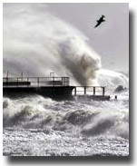
The increased precipitation for Central and Southern California is a concern as well--not just from rainfall, but heavy surf. The higher-than-normal precipitation for the lower regions of California are due to a lowering of the jetstream that guides surf-producing (and rain-making) storms to the West Coast, allowing powerful storms to direct their wave energy directly at Central and Southern California beaches.
Still, at this point, nothing too drastic is expected for the winter of 2006 from El Niño. Yet it's believed that the current El Niño could build a little more steam in the next couple of months, which could of course change the winter outlook. How rapid this shift may unfold, and the final intensity that it reaches, could signal concern for our changing climate. But looking at where we are now, as well as the El Niños of the past, it would be a bit premature to ding the global warming alarm bell on this year's El Niño event. Nevertheless, this latest cycle on our world's weather will be watched with trepidation to see what Mother Nature has to offer this coming winter.
|
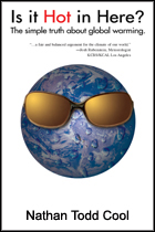
To stay abreast on similar articles like this, you can signup for the free GreenhouseTruth newsletter. Additional information on El Niño, ENSO cycles, decadal cycles, global temperatures, and other topics discussed in this blog can be found in Nathan Cool's new book, Is it Hot in Here?--The simple truth about global warming. Click here to get your copy. |
|